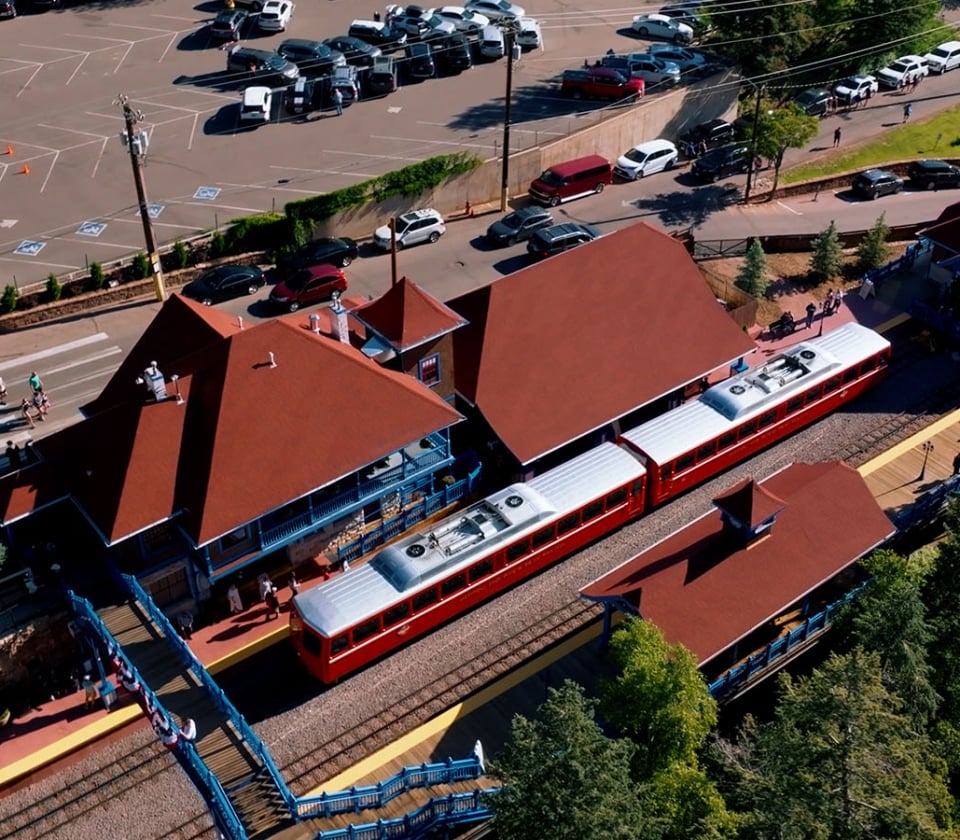
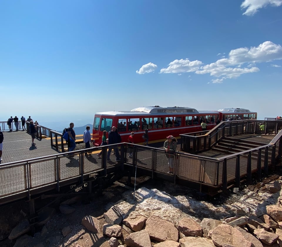
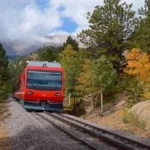
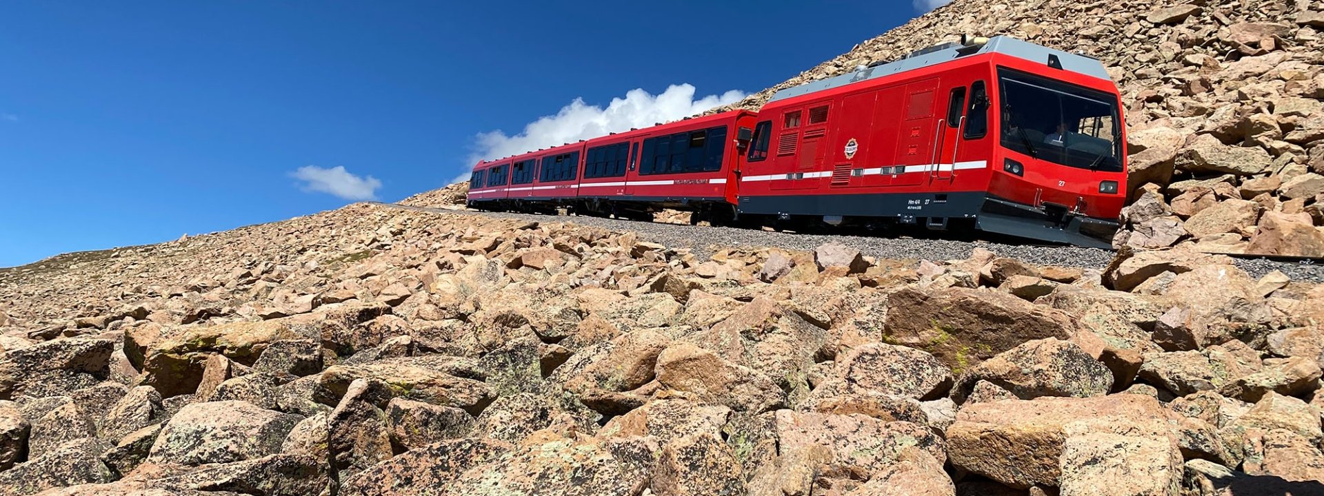
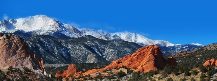
|
|
|
|
Hiking and Biking in the Pikes Peak region
(Hiking and Biking in Colorado Springs) |
Hiking-Summer
Trails
Hiking-Year round Trails
Road Biking
Mountain Biking

Mountain Biking on Capn' Jacks
We believe that the Pikes Peak region offers incredible
opportunities for the athletic person. Whether you are a world-class competitor
or a weekend warrior, there are great trails and roads to be explored. Other
Colorado towns have more cachet, but we believe Colorado Springs is world-class
in its variety of trails, access and proximity to amenities like top-drawer
lodging and dining. And if you want to catch the
Rockies, Nuggets, Avalanche or Broncos (or a touring
Broadway show or top-notch musical entertainment), Denver is only
an hour and a quarter away!
We'll start with hiking/running trails in the area. We
will divide them into year-round and seasonal. Seasonal trails will have patches
of ice or snow on them (usually only in the shade) due to the proximity to the mountains
from about November 1st through April. Most years, these dates will vary: we
have hiked trails on Christmas Day when they are totally dry, but other years they
may still be icy in May. Keep in mind that the locals use all these trails all year
long; this packs the snow down and can make them icy in spots, but locals will
have equipment to handle these conditions (shoe "grippers" and hiking poles, for
example). Even the
year-round trails can get slippery for a week after a big snow-fall.
YEAR ROUND TRAILS-Hiking
One does not need to travel farther than the Garden of the
Gods to experience some incredible trails and roads for hiking and running. The
City of Colorado Springs has an excellent section on their website showing many
trails (including Garden of the Gods, Palmer Park, Cheyenne Canyon and Red Rock Canyon-mentioned in this section)
here
(and scroll to the bottom of the page on their site). The
interactive trail maps are not as detailed or as readable as the PDF maps, in
our opinion.
One could spend two days in the Garden of the Gods hiking the trails. We especially like
the Siamese Twins/Cabin Canyon area, the Susan Bretag/Palmer Trail loop (back
through the Gateway Rocks) and the Niobara/Ute Trail areas for their views.
Palmer Park is a large park in the middle of the city
where the views are beautiful and the trails are almost always clear of snow and
ice. The east
side features spectacular views of Pikes Peak, Garden of the Gods and downtown
Colorado Springs. The Templeton Trail is very beautiful with the trail on the
top of the bluff in many areas. Again, refer to the Colorado Springs Parks web
site
here.
Red Rock Canyon is the newest Colorado Springs City Park.
We like Contemplation Trail and Quarry Pass trails; some people actually prefer
it to Garden of the Gods; again refer to the Colorado Springs Parks site for
maps.(Again
map
here)
SEASONAL
(Spring, Summer and Fall) TRAILS -
Hiking
The Big Daddy is Barr Trail; 13 miles and 8000 feet from
Manitou Springs to the Summit of Pikes Peak. Locals (as mentioned above) hike
this all year long, but in the winter it can become very icy on the switchbacks
in the shade (over the first three miles) so be cautious. Additionally, the
trail above timberline becomes obscured in the winter by snow; usually crampons
and an ice axe are needed when this happens.
Matt Carpenter's site offers the
best links for this trail. There is also a $0.25 map available at the Cog that
has a rough map of Barr Trail. A good intro to the trail is the walk to Barr
Camp (7.5 miles up one-way). While Barr Trail is impressive, its sheer length is
what makes it daunting. The first few miles are a real slog, with many
switchbacks; after you reach the middle miles, you have a little more of a
gradual climb with views of the surrounding mountains; you only see Pikes Peak
occasionally. After you leave Barr Camp (make sure you stop at Barr Camp
to get updated weather info, restock on supplies, etc.), you begin to climb in
earnest. This is where the altitude starts to affect a person's metabolism.
If you don't have a planned way down, be prepared to walk back down.
Thunderstorms in the summer and snow in winter can shut the summit house down
and prevent the trains and the highway staff from making it to the summit or
force their early departure. ALWAYS have extra warm (rain/snow proof) clothing
and plenty of water and snacks!
Waldo Canyon is located up highway 24 about 2 miles above
Manitou Springs. There is a big parking area on the right side about 1.5
miles past the Cave of the Winds stoplight along Highway 24. This is a beautiful
7 mile loop; 1.5 in, a 4 mile true loop and
the 1.5 back out. It too gets icy in the winter on the steep shady parts. Once
you reach the loop, it is generally best to go clockwise so you ascend the
slippery areas and coming down is a more gentle grade. It is VERY popular on
weekends, so for more solitude, do it during the week.
Cheyenne Canyon offers some great trails. See
this (same Colorado Springs Parks link as
above) for some maps. Columbine is somewhat steep but very beautiful. We like
starting at the Starsmore Center and going all the way to Helen Hunt Falls.
Doing just the Helen Hunt Falls trail is a nice, quick jaunt as is the Mt.
Cutler Trail.
BIKING
Road Biking
Road biking is great in Colorado Springs. There are
numerous bike paths and side streets that are ideal. Due to our temperate
climate, they can all be ridden year-round EXCEPT after heavy snows. It usually
takes three full days and the streets are cleared again (but watch for loose
gravel dropped by the plows). Even in December and
January (except on rare years), you can ride in comfort in mid-afternoon on the roads.
Garden of the Gods is an incredible ride; the hills give
you a good workout. We usually start in Manitou, ride past Balanced Rock, down
Ridge Road (except for the last steep drop back to Colorado Ave.), ride out to
the Visitors Center and up the bike path (Foothills Trail) to Glen Eyrie (open
Monday through Friday-ride through Glen Eyrie if possible for the beautiful
grounds), through there and back
along the bike path (Foothills Trail), up towards the Gateway Rocks, and back
past Balanced Rock and into Manitou Springs on El Paso. See the map above
(linked again
here).
The Air Force Academy is once again open to road bikers,
so there is a nice 12.5 mile loop there.
Here is the Air Force Cycling
team's map. You also MUST have a valid photo ID to get on the Academy grounds.
Just to the east of Colorado Springs are
numerous small roads that stay dry all year long and where you can put in some
serious miles. Check out Mapquest or Google maps; the Squirrel Creek Rd., S.
Peyton Highway, Hanover Rd., Old Pueblo Rd. and Link Rd. loop is a very nice,
rolling 39 mile (approx) loop. You can also drive up to Woodland Park and ride on Highway 67 to
the little town of Deckers (45 miles round trip) almost year-round. The views are very nice.
Here is a great
link for road bike loops in and around the Springs
(courtesy of the Colorado Springs Cycling Club).
Last but not least.....Mountain Biking!

Rippin'
it up - Jones DH
|